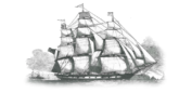
Presented below are links to various documents, maps, and drawings which describe the journey and challenges encountered by the Wends/Sorbs as their pilgrimage to America unfolded. More will be added here as our researchers finalize their works. |
|
Accounts taken from English, Irish, and American newspapers and journals of the medical challenges facing passengers, and the medical care received. |
|
| Cemetery at Clonmel | Old Church cemetery at Clonmel, Ireland. As the Ben Nevis was anchored in the bay, the deceased were placed in small boats and taken to the small quay, or wharf, at Cuskinny. From there, they were carted down the Tay Road to the Old Church at Clonmel, north of Cóbh (pronounced "cove"). Many if not all were buried in unmarked graves. The Google Earth view below is the better of the two. Click for Google Maps view of cemetery. Click for Google Earth view of cemetery (Must have Google Earth installed). |
| Cholera! | What it is, and how it affected the 1854 trip of the Wends to America. |
7. What is the highest point above sea level on the Delaplain League? 8. When rain falls on the Delaplain League, what river does it feed? 9. In what year was Lee County organized? 10. What are the counties out of which Lee County was formed? |
|